Historical background
Dhaka is the capital city of Bangladesh. It is situated on the northern bank of river Buriganga and conveniently located centrally within the country. Today, it is emerging as a modern mega-city and very eager to catch up with cities like Kuala Lumpur and Singapore. The history of the city goes back to 1610 when it was first established as the provincial capital of Bengal (Bengal, Bihar and Orissa) by the Moghul Subahdar (viceroy), Islam Khan Chisti. It was a major centre for economic activities during the 17th century, attracting traders from around the world, including Europe and Central Asia. Hotel-like rest houses, such as Choto Katra and bara Katra, were built for their conveniences, some of whom stayed for several months to complete their business transactions.
Many European nations obtained permission from the Bengal ruler to set up factories to carry out their trading activities,primarily to purchase Bengal products. Although a variety of products were available, the most famous item was the Dhaka Muslin, a highly sought after fabric around the world. Among those who set up factories included the Portuguese, English,French and Dutch.
The city’s fate first began to change in 1717 when the capital of the Moghul province was shifted to Murshidabad, situated in present-day West Bengal in India. Subsequently, after the Battle of Plassey in 1757 and the British conquest of Bengal, the city began to experience a dramatic decline. The scale of this can gaze from the population table below.
The recovery of Dhaka city began during the 1840s and the catalyst for major developments were the setting up of the elected Dhaka Municipality in 1885, Bengal partition in 1905, establishment of Dhaka University in 1921, creation of Pakistan in 1947 and independence of Bangladesh in 1971. This exhibition will trace the history of Dhaka City since 1610 and focus on present day dynamism of the capital.
| Year | Population |
| 1608 | 30,000 |
| 1700 | 900,000 |
| 1800 | 200,000 |
| 1838 | 68,000 |
| 1867 | 51,636 |
| 1891 | 83,000 |
| 1911 | 126,000 |
| 1941 | 240,000 |
| 1951 | 336,000 |
| 1961 | 550,000 |
| 1974 | 1,680,000 |
| 1981 | 3,440,000 |
| 1989 | 5,000,000 |
| 2001 | 10,712,000 |
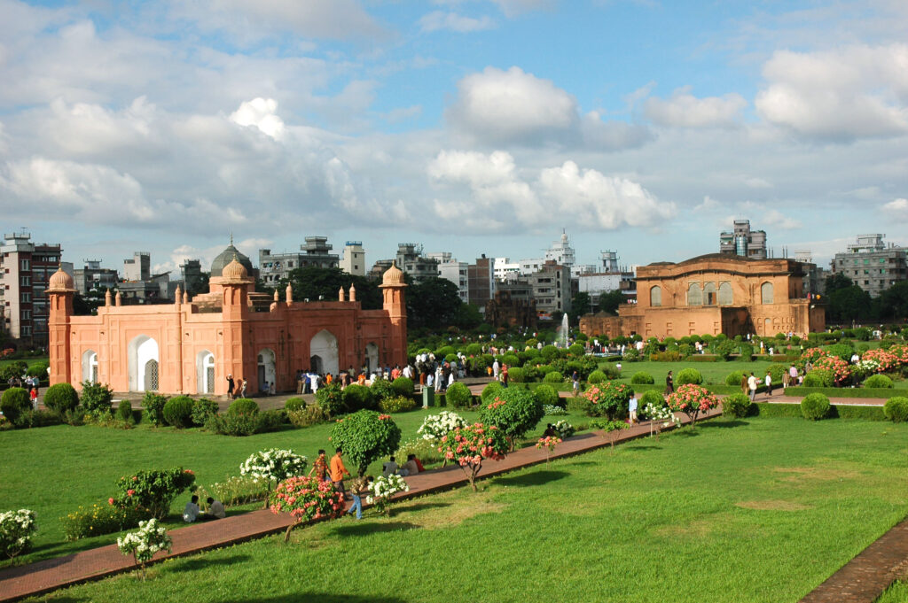
The construction of Lalbagh Fort (above) was started in1678 by Moghul subahdar (viceroy) Muhammad Azam and continued by his successor Shaista Khan in 1679. Shaista Khan served as the subahdar during 1664-88 with a short break when Muhammad Azam was appointed (1678-79). It remains an incomplete Moghul palace fortress, originally situated on the river Buriganga, but now the river has shifted. The mosque like structure is the mausoleum of Bibi Pari, the daughter of Shaista Khan who died early in 1684 at the age of thirteen. This was a great shock to the subahdar. The work was discontinued and not re-started before his successor Ibrahim Khan was in post. The complex now consists of three main buildings – a mosque (out of view in the above picture), Bibi Pari Mazar and a musem – a huge pond and a number of ruins. The domed roof of the mausoleum is based on a unique synthesis of Hindu interior and Muslim exterior designs.
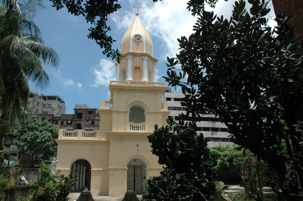
Holly Rosary, a Portuguese church built in 1677, situated in Tejgao. It is now part of a complex where the main Catholic Church of the city is based. As well as the main church building sitting opposite, this building is also used by the city’s Catholic community for worship.
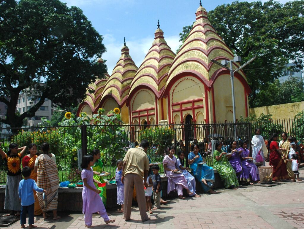
Dhakeshwari Temple, the most prominent Hindu place of worship in Dhaka. According to legend it was built by King Ballalsena around eight hundred years ago, during the Sena period in Bengal history. The architecture and colour makes it a uniquely recognisable Dhaka landmark.
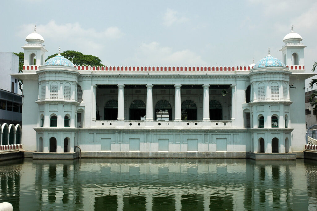
Husaini Dalan, a Shiite place of worship, situated near Chauk Bazar. Its origin goes back to the Moghul period, although repaired several times subsequently, especially after the 1897 earthquake. As well as normal daily worship, the centre also hosts events, such as the annual Ashura.
Armenian Church, built in 1781 and situated in Armanitola on the site of a previous smaller construction where the same community worshipped. The church has a graveyard and from the inscriptions on the gravestones, the origins of many of Dhaka’s Armenians can be established.
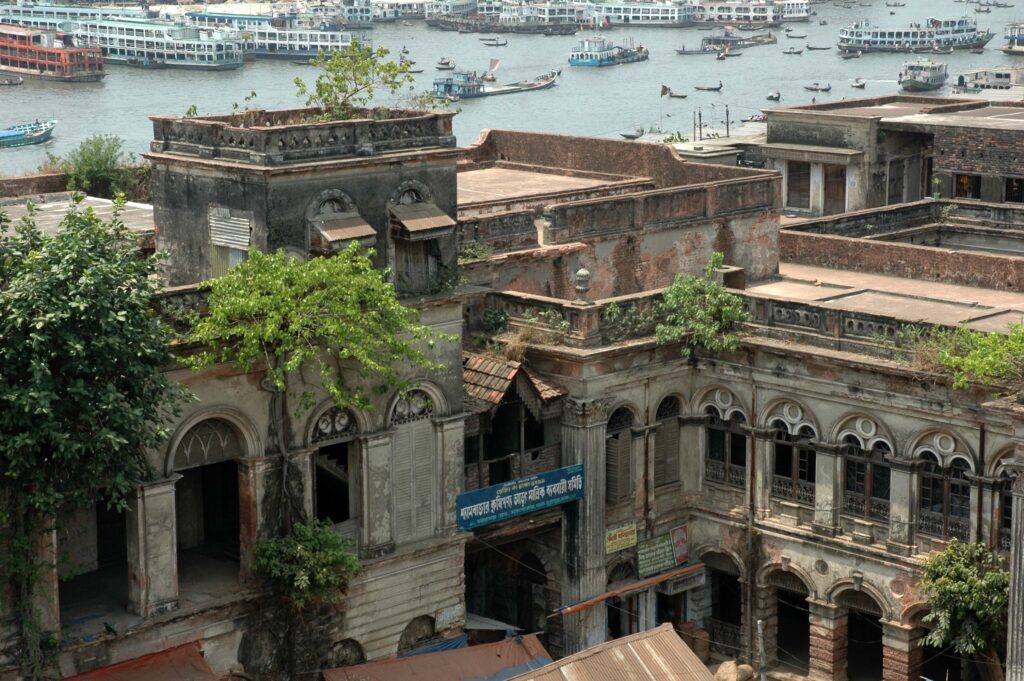
Ruplal House, a 19th century building on the Buriganga riverfront. Jointly built by two wealthy merchant brothers, Ruplal and Ragunath Das, on the site of an old Armenian building, purchased in 1840 from Aratun, a business tycoon. It was styled on European Renaissance architecture.
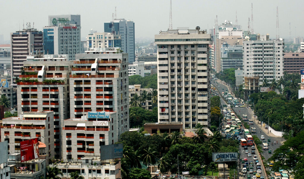
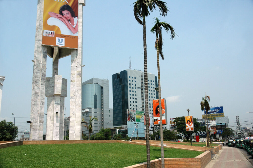
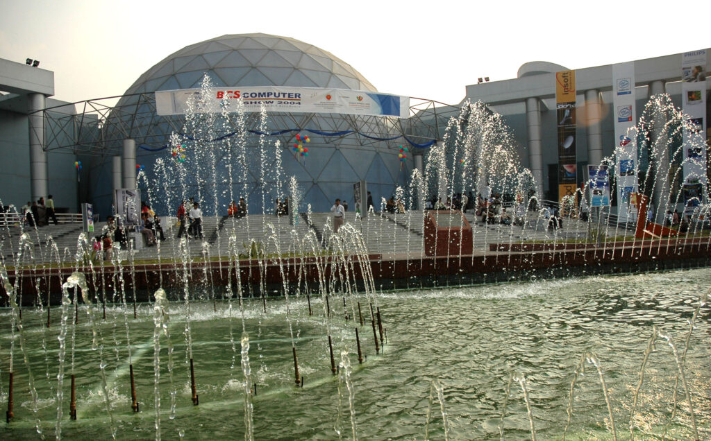
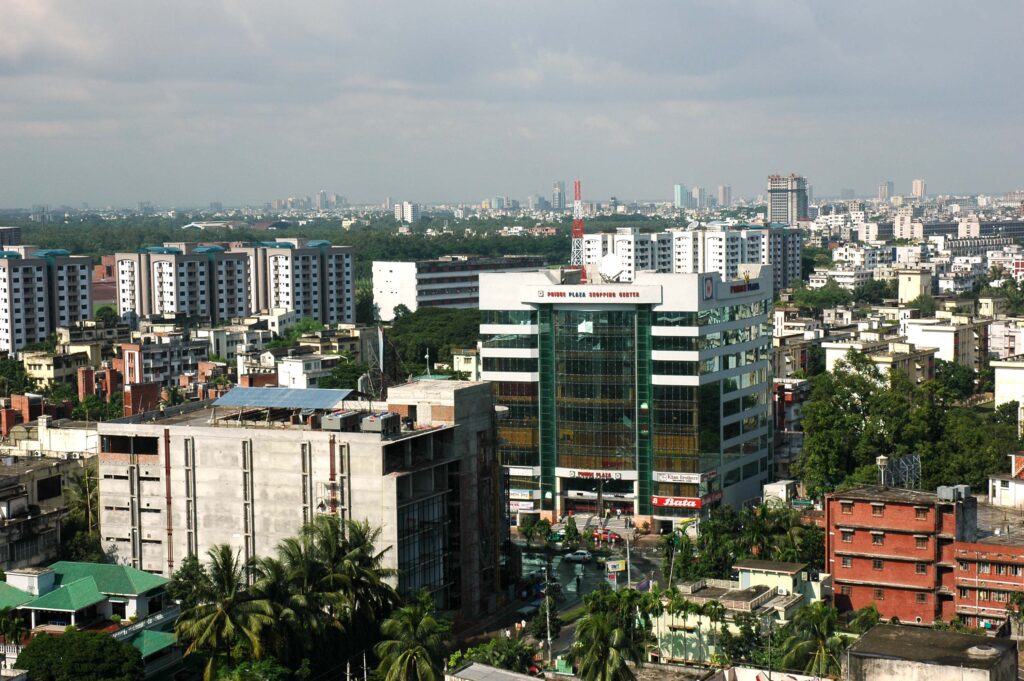
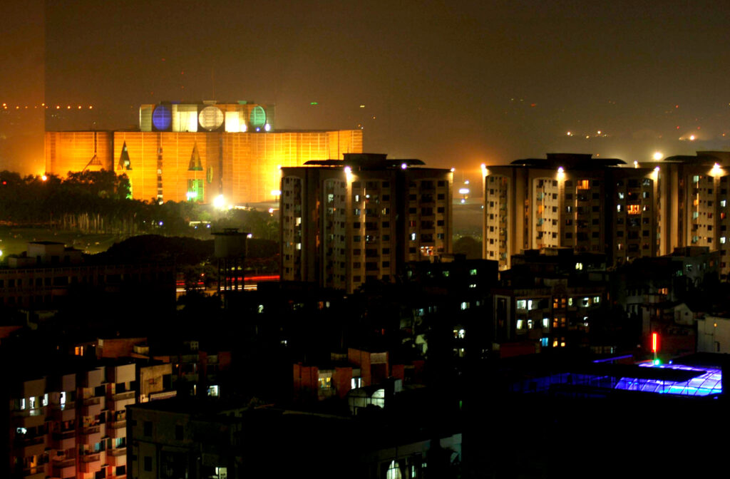
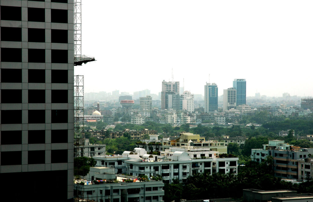
The pictures below show the modern and developing faces of Dhaka city. Recently, the pace of change has accelerated and it is clear that Dhaka City architecture is becoming, on the one hand, more South East Asia like with tall buildings, and on the other, more varied, creative and interesting in terms of efficiency, utility, quality and aesthetics. Skyscraper alleys are beginning to emerge and mega shopping centres and beautifully designed and constructed buildings, green spaces and public arts will form the future faces of Dhaka.
Bangladesh
Government: Bangladesh has a parliamentary system of government, where the Prime minister is the head of the government and the President is the head of the state.
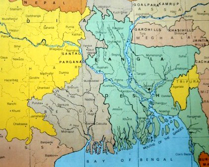
Geographical location: Bangladesh is a South Asian country, 20°34′ to 26°38′ north latitude and88°01′ to 92°41′ east longitude. Maximum extension is about 440 km in E-W direction and 760 km in NNW-SSE direction.
Time and Area: GMT + 6.00 hours. Approx: 148,000sq km (55,000sq mile). Currency: Taka (Tk57.10 = US$1, March 2002),
Boundaries: Mostly surrounded by India except in a part of south-east Chittagong where the country shares a border with Myanmar. Bordering Indian states are West Bengal, Assam, Meghalaya, Tripura and Mizoram. The total length of the land border is about 4,246 km, of which 93.9% is shared with India and the rest 6% with Myanmar.
Administrative units: The country is divided into six divisions (chittagong, khulna, rajshahi, barisal,sylhet); 64 district; 507 upazila and thana 507, 4,484 union, 59,990 mouza 59,990, 87,319 villages;and 4 city corporations (Dhaka, Chittagong, Khulna, Rajshahi); municipality 223.
Physiography: A humid low-lying alluvial region, Bangladesh is composed mainly of the great combined delta of the Ganges-Brahmaputra-Meghna rivers. It is one of the largest deltas in the world. The monotony of flatness has been relieved inland by two elevated tracts – the Madhupur and the Barind tracts, and on the northeast and southeast by rows of hills. Some 75% of the land is less than 3m above mean sea level (MSL) and vulnerable to floods and cyclones. The maximum elevation is 1,280m above MSL at Saichal Range in Rangamati district. Tajingdong is the highest peak and called as Bijoy.
Energy sources: Fuel wood, natural gas, liquid petroleum fuels, coal, hydropower, solar power,biogas, etc.
Rivers: Total rivers including tributaries and distributaries are about 700 under three mighty riversystems: ganges-padma river system, Brahmaputra-Jamuna river system and Surma-Meghna river system. Rivers of the southeastern hilly region are considered as the chittagong region riversystem. Principal rivers are: Ganges, Padma, Brahmaputra, Jamuna, Surma, Kushiyara, Meghna,Karnafuli, old Brahmaputra, Arial Khan, Buriganga, Shitalakshya, Tista, Atrai, Gorai, Madhumati,Kobadak, Rupsa-Pashur and Feni.
Climate: Sub-tropical monsoon. Average maximum and minimum winter temperatures are 29°C and11°C respectively; average maximum and minimum summer temperatures are 34°C and 21°Crespectively. Annual rainfall 1,194 mm to 3,454 mm. Highest humidity 80% to 100% (August-September), lowest 36% (February -March).
Population: (2001) total population 123.1 million; density 834 persons per sq km, annual growth rate(1991-2001) 1.47%, male-female ratio 106:100, urban population 28.8 million, rural population 94.34million. Life expectancy at birth (1998) is 61 years. At the point of ethnicity Bangladeshi people areamalgamation of Dravidian, Proto-Australoaid, Mongoloid, and Arian. Tribal people with apopulation of just over 1.2 million occupy mainly Khagrachhari, Bandarban, Rangamati, Chittagong,Cox’s Bazar, Habiganj, Sylhet, Sunamganj, Maulvi Bazar, Dinajpur, Joypurhat, Rajshahi, Naogaon,Rangpur, Bogra, Nawabganj, Mymensingh, Netrokona, Narguna and Nhola districts. There aresome 45 tribal groups in Bangladesh and among those Chakma, Garo, Hajong, Khasia, Magh,Santals, Rakhain, Manipuri, Murong are notables.
Religion: Muslims 88%, Hindus 11%, the rest being Buddhists, Christian and animist.Language: National Language: Bangla (99.5% speak Bangla and 0.5% other dialects). English is the second language.
Literacy: (7 years and above) 48.7 % (1997-98).
Educational institutions: Public university (1998) 14, private university (2001) 19, government medical college 16, private medical college 19, engineering college 6, polytechnic institute 21, college (general education) 2288, secondary school 14069 and primary school 65610.
Transport and communication: Metalled road 10,000 km; Railways 2,891 km. Waterways 8,900km.
Health facilities: (1999) Hospitals 1,289 (of which Upazila Health Complex and Rural HealthComplexes are 398); hospital beds 43,143; registered physician 30,864; households per physician674;
Employment and occupation: (Labour Force Survey 1990-91, in million) technical andprofessional 1.46; administrative and managerial 0.19; clerical works 1.10; sales works 4.02; service works 1.68; agriculture, forestry and fisheries 34.35;production and transport 6.98; not adequately defined 0.38.
Mineral resources: natural gas, coal, peat, limestone, hardrock, beach sand heavy mineral (zircon, rutile, Ilmenite, Garnet, Magnetite, Monazite, Leucoxene, Kyanite), glass sand, white clay, brick clay and metallic minerals.
Water resources: Bangladesh is endowed with plenty of surface water and groundwaterresources. Surface water inflows of the country vary from a maximum of about 140,000 cumec in August to a minimum of about 7,000 cumec in February.
Industries: Jute, tea, textile, garments, paper, newsprint, fertiliser, leather and leather goods, cement, sugar, fish processing, pharmaceuticals and chemicals.
Principal fruits: Mango (am), jackfruit (kanthal), black berry (jam), pineapple (anaras), banana (kala), litchi (lichu), lemon (lebu), guava (peyara), papaya (pepe), tamarind (tentul), watermelon (tarmuj), rose apple (jamrul), jujube (barai).
Principal crops: Jute, rice, wheat, potato, tea, tobacco,
Airports: Zia International Airport, Dhaka; Amanat Shah International Airport, Chittagong; Osmany Airport, Sylhet; Cox’s Bazar Airport; Jessore Airport; Barisal Airport; Rajshahi Airport; Saidpur Airport,Nilphamari; Ishwardi Airport, Pabna; Tejgaon STOL Port, Dhaka; Shamsernagar STOL Port, Maulvi Bazar; Comilla STOL Port, Comilla; Lalmonirhat STOL Port; Thakurgaon STOL Port.
Food: Staple diet: rice, wheat, vegetable, pulses, fish and meat.
Flora: 6000 species (5000 flowering plants).
Principal fishes: Freshwater fishes: hilsa (Ilish),[tenualosa ilisha]; carps (rui, katla, mrigal, kalibaus,etc); barbs (punti, mahashol, etc); minnows (darkina, chela, mola, etc); catfishes (Tengra, Aid, Shingi, Magur, etc); climbing perch (Koi), [Anabas testudineus]. Saline water fishes: jew fishes (poa), thread-fins (tapasi), mullets (bata), pomfrets (rupchanda), etc.
Fauna: Vertebrates: about 1600 species; Fish: 266 inland species and 442 marine species; Amphibians: 22 species; Reptiles 126 species (109 inland and 17 marine); Birds: 628 species (388 resident and 240 migratory); Mammals: 113 species (110 inland and 3 marine).
Forest: Total 21403 sq km. Hill forest land 13,617 sq km; Inland forest land 1,220 sq km; Littoral forest 6,566 sq km.National days: Shaheed Dibas (Martyrs’ Day) on 21 February now observed as international mother language day; Swadhinata Dibas (Independence Day) on 26 March; Pahela Baishakh or Bangla Nababarsa (Bangla New Year); Bijoy Dibas (Victory Day) on 16 December.
Festivals: Common: Navanna, Pahela Baishakh (Bangla Nababarsha). Religious: Muslim, Eid-ul Azha, Shab-e-Qadr, Shab-e-Barat, Eid-e- Miladunnabi, Muharram; Hindu Durga Puja, Kali Puja, Laksmi Puja, Saraswati Puja, Doljatra, Holi; Christian Christmas; Buddhist Buddha Purnima.
History and recent developments
Bangladesh is an independent country and Dhaka is its capital and premier city. It gained its independence in 1971, after a nine months bloody war of liberation against the Pakistani occupation forces. Although the actual Liberation War lasted for nine months, the people of this land had struggled for centuries to become free from foreign rule.
Sometimes the full significance of the creation of Bangladesh in 1971 is not fully appreciated or understood by everyone. Very few people realize that the people of this land have become the masters of their own destiny after one thousand years of outside domination. Foreign rule started in late eleventh century with the Hindu Sena rulers who came from southern India and gradually increased their territories after replacing the previous Buddhists Palas. By the early twelfth century Sena rule was firmly establish throughout Bengal. Although their capital city was Vijayapura in West Bengal they had a second capital in Vikrampur, not far from Dhaka city.
The Muslim rule of Bengal started with Ikhtiyar Al-Din Muhammad Bin Bhakhtiyar Khalji, who overthrew the last Sena ruler Lakshaman Sena in 1203/5. ‘Muslim rule’ of Bengali continued for about five hundred and fifty years, lasting until the Battle of Plessey in 1757 when ruler Nawab Sirajuddaula was overthrown by the British.
The British ruled Bengal as part of their British Indian Empire until 1947 when the subcontinent was divided on religions lines and Pakistan was created by carving two chunks of land out of the Indian territories. People of Bangladesh were very hopeful that this time they would be free. However, very soon it began to dawn on them that the Pakistan project, for which they sacrificed so much to help achieve, was not going to deliver the freedom and dignity that they were seeking. They continued to fight for their rights and freedom, but a bloody unjust war was imposed on the innocent people of Bangladesh on 26 March 1971, by the military ruler of Pakistan, General Yahya Khan, after the 1970 election produced a result not anticipated by the dictator.
After nine months of sacrifices Bangladesh became an independent country on 16 December 1971 and in the history of the people of this land a new chapter had begun. Dhaka was the natural and only contender city within Bangladesh to become the capital of this new republic.
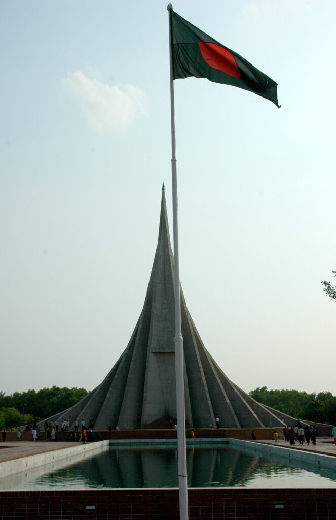
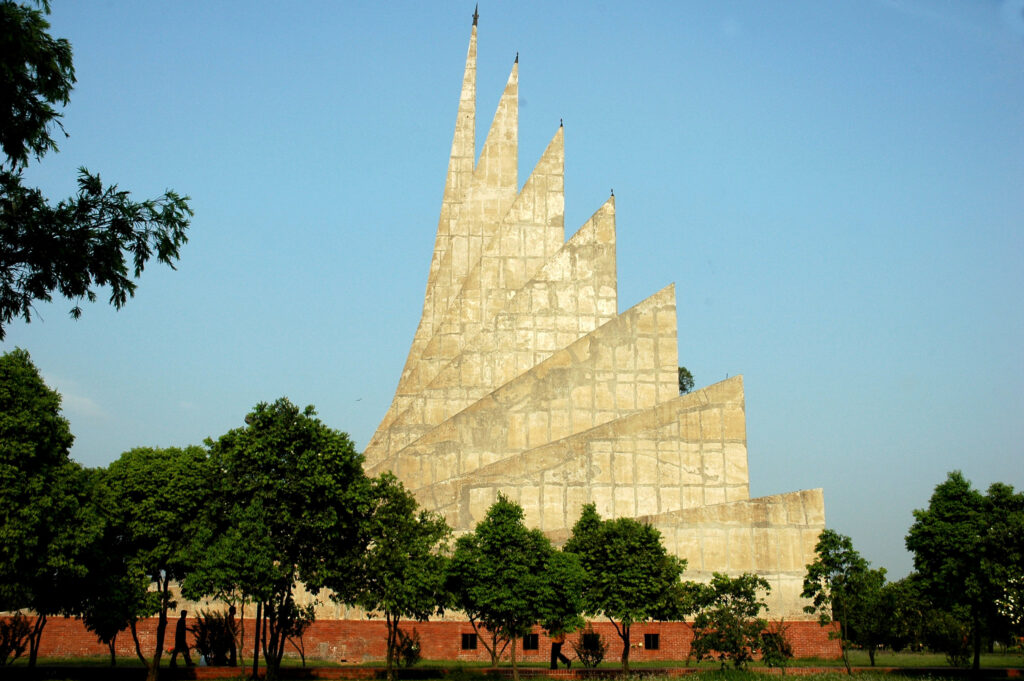
National Martyrs’ Memorial situated at Savar, about 35 km north-west of Dhaka City Since its independence, although Bangladesh started from a very low base – in terms of educational levels, individual and institutional capacities and the state of the economy, compounded by war devastation – the country has achieved many outstanding successes during the last three decades. These include improvements in healthcare; roads and infrastructural expansion; agricultural self-sufficiency and industrial diversification; literacy rate and educational attainment; export growth; democratization and the development of a strong civil society. The capacities of individuals and institutions have continued to improve, and Bangladesh has also experienced sustained economic growth year on year.